
 Safari Planning, Travel Guides & Practical Advice
The Masai Mara National Reserve covers 1,510 km² (about 580 square miles) in Narok County, south-western Kenya, and runs on into Tanzania’s Serengeti. The Mara River divides the Mara Triangle in the west from the rest of the reserve, the Talek and Sand rivers feed it, and the main gates are 225 to 275 km (140 to 170 miles) from Nairobi by road.
This is the Masai Mara map in words and tables, part of our Masai Mara safari guide: the regions, each main gate with its road and drive time, the rivers and crossing points, and the airstrips. For the size and the name, see what the Masai Mara is; for door-to-door times, our guide to the Masai Mara from Nairobi.
Planning this trip? Get a free quote in 6 hours →
Masai Mara at a glance
| Detail | Figure |
|---|---|
| Reserve area | 1,510 km² (about 580 sq mi); the wider Greater Mara study area is more than 3,000 km² |
| Elevation | About 1,500 to 2,200 m (4,900 to 7,200 ft) |
| Main rivers | Mara, with its tributaries the Talek and the Sand |
| Distance from Nairobi | About 225 to 275 km (140 to 170 mi), depending on the gate |
| Drive time | 5.5 to 6 hours to the eastern gates; 6 to 6.5 hours to Musiara and Oloololo |
| Flight | 45 to 60 minutes from Wilson Airport to a Mara airstrip |
| Reserve ticket | 12 hours, 6:00 am to 6:00 pm, whatever time you enter |
The Masai Mara region by region
Camps and guides describe the Mara in a handful of areas. These are the ones you meet when you book.
| Region | Where it is | What to know |
|---|---|---|
| Mara Triangle | South-west, west of the Mara River; 510 km² (200 sq mi), with the 400 m Oloololo Escarpment on its north-western edge | Run by the not-for-profit Mara Conservancy, with its own tickets. Only Mara Serena Safari Lodge and Little Governors’ Camp are inside. See Mara Triangle vs Greater Mara. |
| Musiara Marsh and the north | North of the reserve | Musiara Marsh is linked to the Marsh Pride lions of the BBC series Big Cat Diary. Musiara Gate and airstrip; Governors Camp is listed here. |
| Central plains and Talek | Centre-east, along the Talek River | Talek Gate, the Ol Kiombo airstrip and camps by the river. Budget camps sit beside Talek village. |
| Sekenani and Keekorok | East and south-east | Sekenani Gate is on the road from Narok, and Oloolaimutia Gate is 12 km beyond it. Keekorok lies in the south-east. Mid-range and budget camps cluster outside the gates. |
| Conservancies | North, east and west edges | Maasai-owned land leased for tourism: Mara North, Olare Motorogi, Naboisho, Ol Kinyei, Lemek, Enonkishu (the northernmost point), Siana in the east, Olderkesi in the south-east, Nashulai in the west. Fewer vehicles; night drives and guided walks allowed, which the reserve does not permit. Ol Kinyei, Naboisho and Olare Motorogi had the highest lion densities in the 2025 survey. |
Distances inside the map are bigger than they look: Oloololo Gate to Purungat Bridge, two Triangle entry points, is a little over an hour at 50 km/h on graded murram roads. On a short stay, choose one or two areas rather than crossing the whole map. Our 3-Day Maasai Mara Roar and Roam Safari suits a first look, from USD 1,420 per person; prices depend on season, group size and lodge choice.
Masai Mara gates: roads, distances and drive times
Distances are road kilometers from Nairobi City Hall, calculated with OpenStreetMap routing on 25 October 2026. Drive times are operator ranges, because routing engines (which give about 3 h 20 to 4 h) ignore Mai Mahiu traffic, lorry queues and stops.
| Gate | Side | Road from Narok | Distance from Nairobi | Drive time |
|---|---|---|---|---|
| Sekenani | East | C12 | 227 km (141 mi) | 5.5 to 6 hours |
| Oloolaimutia | South-east | C12, 12 km past Sekenani | 242 km (150 mi) | About 6 hours |
| Talek | Centre-east | C12 | 246 km (153 mi) | 5.5 to 6 hours |
| Musiara | North | C13 (Aitong road) | About 265 km (operator figure) | 6 to 6.5 hours |
| Oloololo | West, Mara Triangle | C13 (Aitong road) | 253 km (157 mi); operators say about 275 km | 6 to 6.5 hours |
The usual route runs west from Nairobi through Rironi, down the Mai Mahiu escarpment into the Rift Valley, then through Suswa to Narok, 141 km (88 miles) from the city. Narok is the last big fuel stop and has banks and supermarkets. The C13 to Musiara and Oloololo is rougher, needs a 4×4 and adds about 30 minutes.
The 86 km Narok to Sekenani road was rebuilt in bitumen and reported complete in June 2021, but residents blocked it on 30 July 2026 over its condition. Treat it as paved but in poor repair in places, and ask for current conditions. One operator says no entry after 6:30 pm and advises being in camp by 7:00 pm, so avoid a late start.
Non-resident adults pay USD 100 per day from 1 January to 30 June and USD 200 per day from 1 July to 31 December; children 9 to 17 pay USD 50. The Triangle sells its own tickets at Purungat Bridge, Oloololo Gate and Serena Airstrip, and the Mara Conservancy says guests staying in the Triangle who drive in through Sekenani should pay at Purungat Bridge, not at Sekenani. Conservancy fees are separate, so ask your camp whether they are in the rate. Fees last verified: October 2026.
Which gate for which camp area
The gate nearest your camp is usually the right one. Camp names below come from safari directories, not camp websites, so confirm the gate or airstrip with your camp.
| Camp area | Gate or airstrip | Camps listed there |
|---|---|---|
| Outside the reserve at Sekenani | Sekenani Gate | Sekenani Camp, AA Lodge Mara, Tayari Luxury Camp, Semadep Mara Camp (budget) |
| Near Oloolaimutia | Oloolaimutia Gate | Enchoro Wildlife Camp (budget) |
| Keekorok, south-east | Sekenani Gate, then a drive; or Keekorok airstrip | Keekorok Lodge, Mara Simba Lodge |
| Talek River and centre-east | Talek Gate; Ol Kiombo airstrip | Fig Tree Camp, Mara Intrepids; Zebra Plains Camp and Greenwood Safari Camp near the gate |
| Musiara Marsh, north | Musiara Gate; Musiara airstrip | Governors Camp |
| Inside the Mara Triangle | Oloololo Gate or Purungat Bridge; Serena Airstrip | Mara Serena Safari Lodge, Little Governors’ Camp |
| Oloololo Gate side, below the escarpment | Oloololo Gate; Kichwa Tembo airstrip | Kichwa Tembo Tented Camp, Bateleur Camp, Kilima Camp |
| Conservancies | Set by the camp; ask | Kicheche Mara Camp (Mara North), Mahali Mzuri (Olare Motorogi), Naboisho Camp, Porini Mara Camp (Ol Kinyei) |
Choose your side of the Mara
- 3-Day Maasai Mara Roar and Roam Safari: a short private trip for a first look; from USD 1,420 per person.
- 6-Day Fly-In Big Five Safari: Amboseli and Mara: a fly-in itinerary covering two parks; from USD 4,043 per person.
Prices depend on season, group size and lodge choice. Get my free quote
Rivers and crossing points
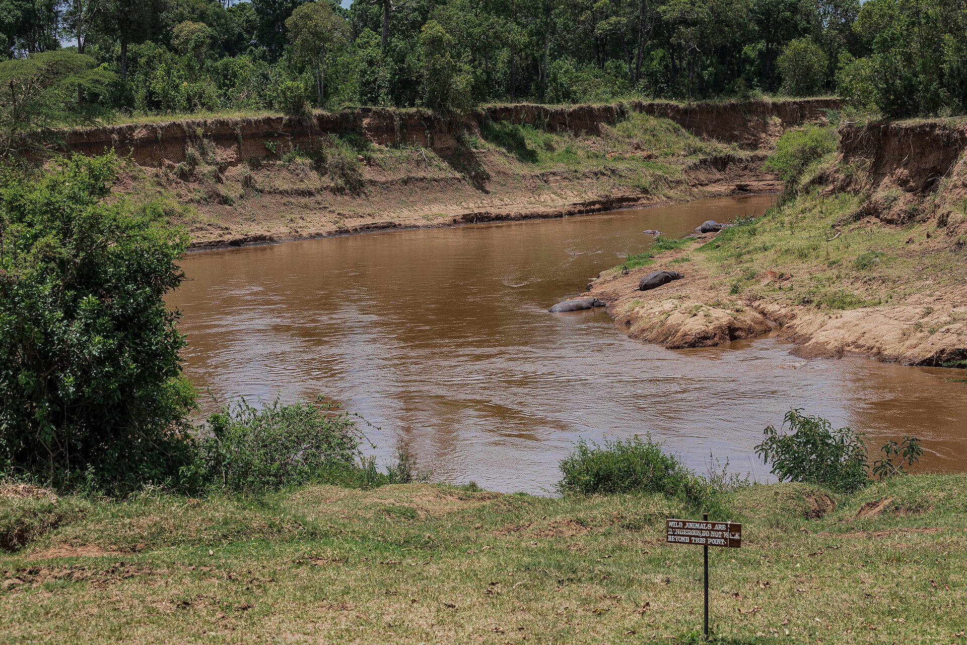
The Mara River is 395 km (245 miles) long. It rises on the Mau Escarpment at about 3,000 m (9,800 ft), runs through the reserve into Tanzania and drains into Lake Victoria. The Talek and Sand rivers are its main tributaries inside the reserve. Crossing names vary by operator and map, and no official list exists; these come from one operator guide.
| Crossing point | What to know |
|---|---|
| Sand River crossing (south-east) | Less dramatic, because the river is usually dry and shallow |
| Crossing 2 (into the Triangle) | The guide also names Purungat, Peninsula, Fig, U, Look-out and Miti Moja |
| BBC Crossing | Best viewed from the western bank, the Triangle side |
| Entim (central) | Isolated; crossings can run for hours, sometimes three days |
| Mawe Mawe | Heavily used, with many crocodiles |
| Cul de Sac (Kaburu) | Crossings occur through almost the whole season |
| Pontoon | Next to Mawe Mawe; only a handful of vehicles can reach it |
Herds are usually in the Mara from about July to October, with the busiest crossings from late July to September, but rain moves the dates and no gate or camp can promise a crossing.
Airstrips: where the flights land
Scheduled flights leave Wilson Airport in Nairobi and take 45 to 60 minutes. Safarilink, AirKenya and Mombasa Air Safari serve the Mara. There are about a dozen airstrips; AirKenya serves 9 of them and Safarilink 8 major ones. Landing at the wrong one can mean about two hours on unpaved roads, so confirm yours. Pairings below come from one operator directory.
| Airstrip | Area | Camps listed |
|---|---|---|
| Keekorok | South-east, near Sekenani Gate | Keekorok Lodge, Ashnil Mara, Mara Simba |
| Ol Kiombo | Centre-east, Talek River | Fig Tree, Mara Intrepids, Tipilikwani |
| Mara Serena | Mara Triangle; the reserve’s largest strip | Mara Serena Safari Lodge |
| Musiara | North, Musiara Marsh | Governors Camp |
| Kichwa Tembo | North-west, below the Oloololo Escarpment | Kichwa Tembo, Bateleur, Kilima |
| Olare Orok | Olare Motorogi area | Porini Lion Camp, Mara Plains |
| Ol Seki, Mara North, Ngerende | Naboisho; Mara North; the north near Enonkishu | Ol Seki is the gateway to Naboisho; Ngerende Island Lodge at Ngerende |
| Siana | East, outside the reserve | Siana Springs, Mara Bushtops |
Luggage is limited to 15 kg (33 lb) in soft bags, including carry-on, on AirKenya and Safarilink; our Masai Mara fly-in safari guide covers airlines and packing. A hot-air balloon flight is an optional extra at USD 550 per person; see Masai Mara hot-air balloon prices.
Get your free safari quote in 6 hours
Tell us your dates and who is travelling. A planner in our Nairobi office replies within 6 hours with a day-by-day itinerary, the camps we suggest and a fully itemised price. No payment is needed to enquire.
Prefer to talk? WhatsApp or call +254 799 871 255.
Frequently asked questions
Which Masai Mara gate is closest to Nairobi?
Sekenani, about 227 km (141 miles) by road, then Oloolaimutia at 242 km and Talek at 246 km. Musiara and Oloololo, in the north and west, are about 265 km and 253 to 275 km. A flight avoids the road and takes 45 to 60 minutes.
Which gate should I use?
The one nearest your camp, confirmed by the camp. Guests staying in the Mara Triangle who enter through Sekenani pay at Purungat Bridge, not Sekenani. Ask how conservancy fees and the reserve fee combine on a day that crosses both.
Where is the Mara Triangle on the map?
In the south-west, west of the Mara River, about 510 km² (200 square miles), under the Oloololo Escarpment. It is part of the reserve, run by the Mara Conservancy.
Which airstrip will I land at?
The one your camp and the airline set, usually the strip nearest the camp. Flights often make one or two stops, and the pilot sets the landing order each morning.
Where can I do night drives and walking safaris?
Only in the conservancies. The reserve allows wildlife drives from sunrise to sunset on marked tracks. Walks are led by an armed ranger, and in Mara North night drives run in designated areas with red filters, ending by 10 pm.
Is the Masai Mara joined to the Serengeti on the map?
Yes, the reserve is contiguous with Serengeti National Park, which is why the herds cross. By air, AirKenya’s Mara to Serengeti trip takes about 2 hours 45 minutes, with a flight to Migori, a road transfer and immigration, then a flight from Tarime.
Photo: Masai Mara National Reserve, Kenya – 52515616100 by Ninara, CC BY 2.0, via Wikimedia Commons


Comments are closed